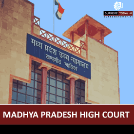
Recent Court Order on Delay in Map Corrections: Key Insights
In property and revenue disputes, delays in proceedings related to map corrections can significantly impact outcomes. A pressing legal question often arises: Recent Order in Map on Delay. Courts have increasingly addressed this, emphasizing pragmatic approaches to condonation while insisting on solid evidence for changes. This blog post breaks down the main findings from recent orders, integrates related case law, and offers practical guidance—remember, this is general information and not specific legal advice. Consult a qualified lawyer for your situation.
Main Legal Finding: Pragmatic Approach to Delays and Corrections
Recent judicial orders stress that delays in map-related proceedings must be explained with . Corrections to maps or revenue records are allowed only when errors are or . Courts adopt a , recognizing administrative hurdles but demanding transparency and evidence.
As noted, the expression '' should be considered with rather than the for 1996 5 Supreme 75. This liberal stance is common for procedural delays, but corrections require justification beyond mere bureaucracy.
00100000141628
Key Principles from Recent Orders
- Courts liberally condone delays due to administrative or procedural reasons, provided they are suitably explained. 1996 5 Supreme 75
- Map or revenue record corrections are permissible for errors or through , ensuring a transparent process.
00100000141628
- When discrepancies arise, such as when area in the khasra is not in line with the map; it is area in khasra that is open to correction, ground evidence prevails.
00100000148124
Detailed Analysis of Delay Condonation in Map Proceedings
Administrative delays are routine in government processes, often due to bureaucratic red tape. Recent orders affirm that substantial delays are excusable if satisfactorily explained, particularly when public interests are at stake. However, courts reject negligence or lack of bona fides. For example, the dismissed a second appeal due to a , underscoring that delays need to be justified with . 2022 Supreme(Online)(Bom) 4975
In another context, a in filing appeals related to a was noted, where the Assessing Officer overlooked its binding nature—highlighting procedural lapses in map-related tax disputes. 2025 Supreme(Online)(ITAT) 6520
Correction of Maps and Revenue Records
Corrections are not arbitrary. They must stem from , soon thereafter it admits correction from spot too.
00100000141628
Ground realities trump assumptions. In property disputes, maps from development plans, settlement records, or revenue departments are pivotal. One case showed a building within a road-line on a standard map, but an enlarged version revealed no impact, swaying the decision. 2025 Supreme(Online)(Bom) 351532Historical modifications add complexity. Pillars and boundaries altered during settlements like Gandovasa affect current claims: has been removed from the map during the recent Gandovasa ... In the recent settlement map, no pillar is shown within the boundary of the map. 2024 Supreme(Online)(NGT) 1540 2024 Supreme(Online)(NGT) 3401 2024 Supreme(Online)(NGT) 5496
Role of Evidence and Witnesses in Map Disputes
Expert testimony is crucial. Deputy Engineers and site map witnesses clarify discrepancies. In a spot map case (Ex.P-2), the deceased's name was absent, but witness PW-2's involvement underscored the need for accurate documentation: The next contention is based on the spot map (Ex.P-2). In this map, the name of deceased nowhere finds place. 2023 Supreme(Online)(MP) 248
Courts favor over technicalities. When khasra areas mismatch maps, corrections align with actual measurements, not assumptions.
00100000148124
Exceptions, Limitations, and Procedural Pitfalls
Not all delays or corrections pass muster:- Corrections based solely on assumptions without ground checks are invalid.- Negligence or lack of bona fides leads to rejection, as in cases where affidavits failed to show . 2025 Supreme(Online)(ITAT) 7389- Unjust boundary alterations without evidence are prohibited.
The and high courts enforce discipline: shows even minor delays need explanation. 2023 Supreme(Online)(MP) 248
Practical Recommendations for Parties Involved
To navigate these proceedings effectively:- Demonstrate errors clearly: Use record discrepancies or ground photos/reports.- Explain delays thoroughly: Provide documentation for administrative hold-ups.- Seek expert verification: Engage surveyors or engineers early.- Courts should balance , avoiding .
In boundary disputes, reference historical settlements like Gandovasa to bolster claims. 2024 Supreme(Online)(NGT) 193 2024 Supreme(Online)(NGT) 2464
Conclusion and Key Takeaways
Recent orders promote a balanced, pragmatic approach to delays in map corrections: condone explained administrative lags, but ground corrections in record errors or verifiable ground realities. Maps remain central in property law, with witnesses and historical data resolving conflicts.
Key Takeaways:- Delays are typically condoned if justified, per justice-oriented pragmatism. 1996 5 Supreme 75- Prioritize ground evidence for corrections.
00100000141628
00100000148124
- Avoid negligence; substantiate every step.This evolving jurisprudence aids landowners and authorities alike. Stay informed on updates, and always seek professional counsel for case-specific strategies. (Word count: 1028)
#MapCorrections, #LegalDelays, #PropertyLaw