


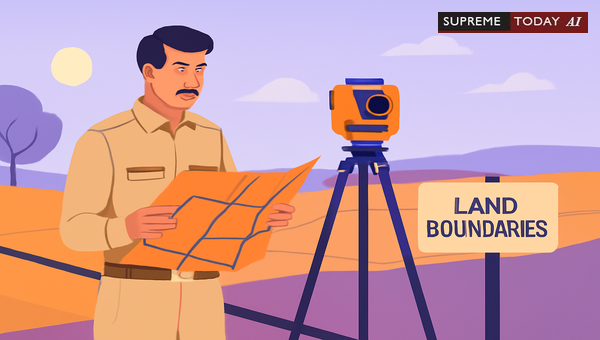
Revenue Officers' Use of Jarib for Land in India
Land disputes over boundaries are common in rural India, often hinging on accurate . A frequent question arises: Can a Revenue Officer under the use Jarib for ? This traditional measuring tool, known as a chain or rope in local practices, plays a key role in physical land measurements. In this post, we delve into the legal framework, authority, practical use, and judicial recognition of Jarib in processes under various state Land Revenue Codes.
Understanding this empowers landowners, farmers, and legal professionals to navigate disputes effectively. Note: This is general information based on legal precedents and statutes; consult a qualified lawyer for advice specific to your case.
Legal Authority of Revenue Officers for
Revenue Officers, such as Sub-Divisional Officers (SDOs) and Assistant Deputy Collectors, hold significant powers under state-specific Land Revenue Codes to demarcate land boundaries. For instance, under the , 1966, and the , 1959, these officers are authorized to conduct physical using various methods, including natural features and existing markers 2003 0 Supreme(Bom) 1046 2022 0 Supreme(MP) 188.
The process typically involves:- Verification of revenue records like and .- Field surveys in the presence of interested parties.- Physical marking of boundaries to resolve or disputes.
Courts have upheld this authority, emphasizing that must align with established procedures to ensure fairness 2010 0 Supreme(Mad) 522.
What is Jarib and Its Role in ?
Jarib is a traditional Indian land measurement unit, roughly equivalent to 20 meters or a chain length, used historically for measuring agricultural fields. While modern Land Revenue Codes do not explicitly mandate Jarib, they empower officers to employ physical techniques, which traditionally include tools like Jarib, especially in rural areas lacking advanced GPS or theodolites.
In practice:- Revenue officers measure plots using Jarib during inspections.- It helps identify , as seen in cases where measurements revealed discrepancies like four chains were found to be less in the Jarib
RAMVEER SINGH vs State of U.P. AND 8 OTHERS -
.- Documentation, including field sketches and , validates these measurements.This aligns with the officers' broad powers for physical techniques 2003 0 Supreme(Bom) 1046.
Judicial Recognition and Case Examples
Indian courts have recognized Jarib-based demarcations when conducted procedurally. In a case, On request made by respondent No.1 No.697 was demarcated by revenue officer under Section 250(2) of the
. This highlights routine use in possession declarations.
Another instance from notes: on inspection of revenue records, it was found that the pond is situated over No.1153 area 0.178 hectares and towards west 0.30 jarib CC road and drain are constructed 2023 0 Supreme(Chh) 226. Here, Jarib quantified on recorded pond land.
In Uttar Pradesh, disputes arose when Jogendra Singh asked him to use Jarib so to make , but during , four chains were found to be less in the Jarib
RAMVEER SINGH vs State of U.P. AND 8 OTHERS -
. Courts intervened to halt unauthorized constructions based on such findings.Further, under Maharashtra's framework, allows revenue officers to handle boundary disputes, implicitly supporting traditional methods 2022 Supreme(Online)(BOM) 2538. Similarly, 's Land Revenue Act, 1964, replaced older codes but retained survey provisions 2023 0 Supreme(Kar) 118.
These cases affirm that Jarib demarcations are legally valid if:- Based on revenue records.- Conducted with notices to parties.- Properly documented and signed 2003 0 Supreme(Bom) 1046 2010 0 Supreme(Mad) 522.
Procedural Safeguards and Limitations
isn't arbitrary. Key safeguards include:1. Due Process: Formal notices, party presence, and record verification 2003 0 Supreme(Bom) 1046.2. Documentation: Officers must sign reports, sketches, and .3. Cost Recovery: Under provisions like Section 250 of or , costs are recoverable as land revenue.4. Challenges: Parties can contest inaccuracies via appeals or civil suits, especially if Jarib measurements conflict with records
RAMVEER SINGH vs State of U.P. AND 8 OTHERS -
.In , 1968, details survey procedures in Chapters V and VI, obligating maintenance of records under 2021 0 Supreme(Bom) 904. Violations, like unauthorized , are impermissible 2024 0 Supreme(Chh) 656.
Revenue officers' definitions vary by state, e.g., under 2015 0 Supreme(Bom) 1396, ensuring only authorized personnel act.
Practical Insights from Other States
Jarib's use extends across states:- /MP: Encroachment checks on plots
2023 0 Supreme(Chh) 226.- Uttar Pradesh: Road construction halts due to Jarib discrepancies
RAMVEER SINGH vs State of U.P. AND 8 OTHERS -
.- Maharashtra: Development permissions tied to 2017 0 Supreme(Bom) 1684.- MP: under 2021 0 Supreme(MP) 39.A Revenue Officer-cum-Assistant Director in exemplifies administrative roles 2020 0 Supreme(Sikk) 65. UP Revenue Code Rules 85-88 govern procedures 2024 0 Supreme(All) 1978.
Despite modernization, Jarib persists for its accessibility in disputes, as noted: Revenue officers utilize the measurement unit Jarib to demarcate land boundaries during land inspections and disputes 2024 Supreme(Online)(MP) 17772.
Key Takeaways and Recommendations
- Permissibility: Revenue officers under Land Revenue Codes may use Jarib for , as it's consistent with physical measurement powers 2003 0 Supreme(Bom) 1046 2022 0 Supreme(MP) 188.
- Validity: Ensured by procedures, documentation, and judicial oversight 2010 0 Supreme(Mad) 522.
- Best Practices: Request demarcations with witnesses; challenge via appeals if needed; maintain records for disputes.
In summary, Jarib remains a legally recognized tool in India's land revenue administration, bridging tradition and law. For enduring boundary peace, prioritize official processes. Always seek professional legal counsel for your situation.
(Word count: 1028. Sources cited are for illustrative purposes; full texts should be reviewed.)
#LandRevenueCode, #JaribDemarcation, #RevenueOfficer












